
The Piri Reis Map
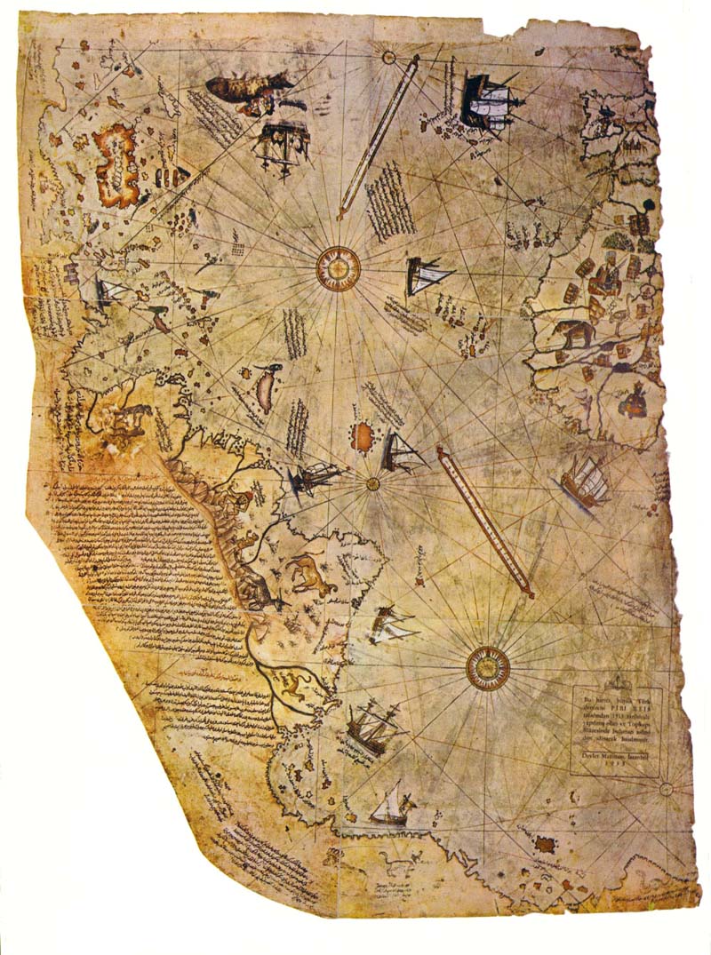 The Piri Re'is map was found in 1929 in the Imperial Palace in Constantinople. It is painted on parchment and dated 919 A.H. (in the Islamic calendar), which corresponds to 1513 AD. It is signed by an admiral of the Turkish Navy named Piri Ibn Haji Memmed, also known as Piri Re'is. According to Piri Re'is, the map had been assembled from a set of 20 maps drawn in the time of Alexander the Great.
This map and others were analyzed by Charles H. Hapgood and his graduate stutents. Hapgood was a historian and geographer at the University of New Hampshire, in his book Maps of the Ancient Sea Kings (1966). Only the conclusions of this book are sensational; for the most part it is a technical monograph on the history and geography of the anomalous maps, employing spherical trigonometry to associate map features with actual geographic locations. This book has recently been republished, and we highly recommend it.
The conclusion that Hapgood reached was that a civilization with high seafaring and mapping skills surveyed the entire earth in the ancient past. They left maps which have been copied by hand through many generations. The Piri Re'is map is a patchwork which has gaps (most notably the Drake Passage between South America and Antarctica) which can be explained as non-overlapping areas between the source maps. Maps of the Ancient Sea Kings and Hapgood's other book The Earth's Shifting Crust, in which he advanced a theory of polar shifts, are controversial, and earned him the scorn of offical academia.
More evidence has appeared in recent years. Hapgood may yet be vindicated (at least his guess as to the signficance of the anomalous maps). The Piri Re'is map is one of the cornerstones of the growing body of evidence for an unknown Ice Age civilization. Along with this we can include the book Hamlet's Mill, by De Santillana and von Dechend (1969), and the works of Graham Hancock.
One striking thing about this map is the level of detail of the coasts and interiors in South America. Although the scale is somewhat off, a long, high mountain range is shown as the source of the rivers flowing to the coast of South America.
However, the best-known feature in the Piri Re'is map (and other pre-modern maps) is the Antarctic coastline. In Hapgood and others' opinions, this represents the outline of the coast of Antarctica without glaciers.continued →
posted by 911truthnc at 8:40 AM
![]()

0 Comments:
Post a Comment
<< Home